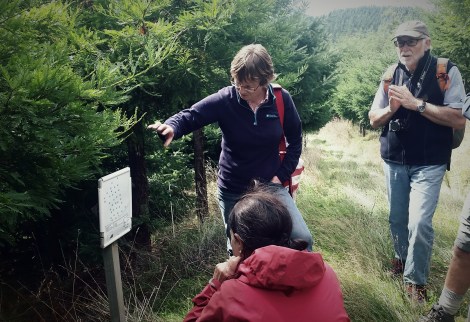
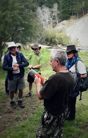
Foundation member Harriet Palmer explains how the individual forestry block are measured and how the data are presented
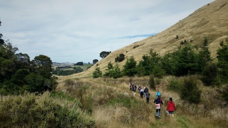
The first citizen science projects tour kicked off in Palmerston North. A group of 20 participants covered a surprising cross-section of the environmental sector representing farming, volunteers, regional government, trusts. I’m struck again by the diversity of people that have come together to learn about what is underway in the region. We had a busy itinerary and managed to fit in two very different projects… read on!
Community forestry trials: expanding landuse options for farmers
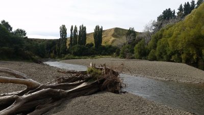
We headed through the Manawatu Gorge to Rewanui, 23km west of Masterton. Rewanui (334 ha) is owned by the Montford Trimble Foundation, and is dedicated to dedicated to growing native and exotic trees ‘for the educational, economic and aesthetic benefit of the public’. We came to learn about the trials that were set up to provide landowners with alternatives to sheep and beef farming in the dry, marginal Wairarapa Hill Country.
Rewanui is situated in the dry eastern hill country of the Wairarapa
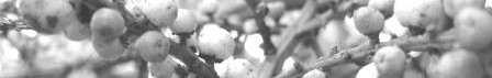
Foundation member Harriet Palmer led us on an hour- long circuit to see the forestry trials. Scattered across the site are blocks, each with 40-50 fifty trees of a single species. Blocks include natives (e.g., rimu, kowhai, kahikatea and kauri), and exotics (e.g., Eucalyptus, Western Red Cedar, Japanese Larch and a range of Redwood clones), with each species valued for their forestry potential.
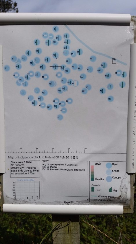
Each block has a print out of the key data e.g., growth rates, overall health, where planted (light, part shade, shade)
Each tree in the trial has been individually identified and measured every year. Special software to store, analyse and visualise the results was developed by former Foundation Chair Ian Campbell. The results for both native and exotic plantings and native plantings are on the Foundation website.
Project sustainability
The 127ha Trimble Forest provides a source of funding from the pine plantation (currently on its 3rd rotation). The focus is now on strengthening the relationship with the local community so that a network of Friends can be built up – last year a huge amount of effort went into developing a community open day. The weather didn’t play along but 60 hardy souls still attended despite horizontal rain attesting to public interest in the site.
The detailed monitoring of each and every tree in each block is hugely labour intensive. A challenge now is not only site maintenance (vigorously growing Muehlenbeckia/pohuehue is beginning to swamp plantings), but also to learn and manage the software that houses and analyses the tree growth data after the untimely death of Ian Campbell. Succession is often identified as a stumbling block for largely volunteer groups. Although leaderships skills may be lost, a tremendous knowledge base may simultaneously be lost. Harriet summed up what the Foundation currently has to work through:
If you’re in the business of growing trees, you’re thinking a generation ahead. If you work with volunteer groups, how do you stay relevant?
Making water quality testing accurate and affordable
Heading through the Manawatu gorge, we drove deep into the heart of the Wairarapa. The farmer we visited, Grant Muir attracted much attention (and abuse) through the award-winning film River Dog. The documentary tells of Grant’s fight to stop local farmers from degrading the health of the river bordering his property – many of their stock are allowed to wander freely along the margins and in the riverbed.
The Pahaoa River runs alongside the Muir’s property
In the wake of Riverdog, Grant developed the Water Action Initiative New Zealand (WaiNZ). The website is the vehicle for River Watch, because to quantify change, you need robust evidence that will stand up in court. However, the cost of devices that accurately measure water quality puts them well out of reach to the general public. But not River Watch. The device (soon available for NZD$2000 – $2500) is about the size of a loaf of bread. It can be anchored in the river, lake or stream, where sensors protected by a sturdy wire mesh case measure key water quality parameters: dissolved oxygen, conductivity, turbidity, temperature and pH. Further sensors can be added to measure water soluble nitrates, phosphates and water flow along with solar panel charging and weather monitoring.
Farmer Grant Muir explains the River Watch water quality monitoring device
The device floats and takes measurements e.g., every 10 minutes for up to 5 days, the internal battery supplemented by a small solar panel fitted to the lid. Measurement data are downloaded to the Riverwatch 2.0 phone app using a Bluetooth connection. GPS tagged data are automatically sent to the WaiNZ website to appear (once approved) on the website’s map.
Largely self-funded though with some help from WWFs Conservation Innovation Fund the development of the tool has drawn together the expertise of engineers, scientists, technicians, software developers, local iwi, farmers and community groups.
Eventually, data stored on the WaiNZ map will build an information-rich picture that show changes in water quality over time. Grant emphasizes that putting an affordable water quality measuring device into the hands of the public is central because ultimately,
Water quality is not a political issue, it’s one that we all share… it’s something that affects us all
… and with the help of the device and the software, something we can all help build a more complete picture around.
